Chivruay 1973. How it really happened.
14-04-2018
Recollections of Dr. Vladimir Borzenkov
Member of the search party in 1973
Almost 50 years have passed since these events. Much has already been erased in my memory, but at the request of some of my friends I wrote this article, because interest has again arisen in that case. And I do not want idle speculations and rollicking shows as is the case with Igor Dyatlov’s 1959 group. Relatives of those who died on Chivruay do not want this. And their feelings must be respected. Here are some interesting observations that may help with the investigation of the Dyatlov group, but they are two different cases.
If we compare three well-known and now widely discussed cases, the death of the Dyatlov group in 1959 in the Northern Ural, the death of the KuAI group in 1973 on the Kola Peninsula, and the death of the group L. Korovina from Petropavlovsk-Kazakh in 1992 in the Hamar-Daban, it should be noted that they can only be similar formally. These are three completely different cases, similar only because group members died and not all circumstances can be explained easily and simply. The first thing I have to say is to describe the location and conditions of the place where the events took place.
On the map of Russia, they are in completely different geographical and climatic regions.
Map of Russia with the location of Chivruay 1973, Dyatlov Pass 1959 and Hamar-Daban 1992
– 2 –
Comparing climatic conditions, it should be noted that:
The Kola Peninsula lies almost completely inside the Arctic Circle and is bordered by the Barents Sea in the north and the White Sea in the east and southeast. Despite the peninsula's northerly location, its proximity to the Gulf Stream leads to unusually high temperatures in winter, but also results in high winds due to the temperature variations between land and the Barents Sea, and sudden changes in weather.

The Kola Peninsula
Members of the Kuybyshev Aviation Institute (KuAI) group on category II difficulty trek:
- Михаил Кузнецов - Mihail Kuznetsov (24) - leader, ski athlete, student of law university
- Валентин Землянов - Valentin Zemlyanov (23) - leader, KuAI graduate
- Илья Альтшуллер - Ilya Altshuller (23) - KuAI graduate, cameraman
- Лидия Мартина - Lidiya Martina (26) - Engineer at the "Ekran" Research Institute
- Александр Новосёлов - Alexander Novosyolov (18) - KuAI freshman
- Юрий Ушков - Yuri Ushkov (18) - KuAI freshman
- Артём Лекант - Artyom Lekant (17) - KuAI freshman
- Сергей Гусев - Sergey Gusev (17) - KuAI freshman
- Юрий Кривов - Yuri Krivov (17) - KuAI freshman
- Анатолий Пирогов - Anatoliy Pirogrov (17) - KuAI freshman
These members remained after two groups of seven members each merged into one since studies and other circumstances prevented four of them from going. The leaders of the two groups were Kuznetsov and Zemlyanov. The route of the hike was: Revda village - Seydozero lake - Chivruay gorge - Vuonnemiyok river - Yuksporrlak Pass - Kirovsk - Imandra station.

Here are some reference points in this narration. The rescue service of all Murmansk region is located in 3 Kirovsk. In 4 Apatity there is large railway station, and between Kirovsk and Apatity is the airport for the central part of Kola peninsula. All civil planes and helicopters for the search operation took off from this airport. The military aircraft took off from the airport in 5 Monchegorsk. 7 Puncha is a former geologists settlement where there was only equipment and materials left in warehouses. Nobody lived in the village except one guard taking shifts on the first on the month. 6 Revda is a relatively large settlement for the Northern and Polar areas of the USSR. This is the starting point for the students of the Kuybyshev Aviation Institute (KuAI), now Korolev Samara aviation State University. They got to 6 Revda by bus from Olenya railway junction of the railway branch Leningrad-Murmansk, 80 km north from Apatity. Usually hiking routes to 2 Lovozerskiye Tundry began from 6 Revda. 9 Umbozero lake is between 2 Lovozerskiye Tundry and 1 Khibinskie Tundry. KuAI group had to traverse the frozen lake after Chivruay pass. End of the route was in 3 Kirovsk, after having passed the part from the route in Khibinskie Tundry starting from Vuonnemiyok river and going through the Yuksporrlak Pass to reach 3 Kirovsk on Jan 31, 1973.
To get from 2 Lovozerskiye Tundry to 1 Khibinskie Tundry in the summer the hikers have to go around 9 Umbozero lake which freezes in winter.
– 3 –
The KuAI group traveled by train №82 Moscow-Murmansk arriving in Olenya railway junction at 9:19 am on January 24, 1973. The group took a bus to Revda, then a service bus to Ilma mining settlement. From there to Elmorayok Pass is 3 km (2 mi) with elevation of 350 m (1000 ft). The group went over Elmorayok Pass and stopped at the forest tree line for overnight by Elmorayok river. This is their first day with the heavy backpacks. It must have been strenuous for the group.
Next day, January 25, they started late and went 8 km (6 mi) along Seydozero lake bank. They didn't have to go any further that day. To go over Chivruay Pass they needed a full day to trek 22 km (15 mi) and climb about 700 m (2000 ft). On January 26 the temperatures in the Chivruay river valley were a little bit below the normal for this time of the year but not by much, about -15°C to -18°C (5°F to 0°F), with high humidity (ca. 80-90%). There was some wind. Lovozerskiye Tundry are shaped like a "horseshoe" open to the west. It rises from Seydozero lake 650-900 m (2000-3000 ft). The leaders have been to these mountains before, but it takes more experience that category II difficulty to account for the probability that the weather on top of the massif could be very different from the bottom of the valley inside the "horseshoe".

Lovozerskiye Tundry
Lev Gugel who was working in the Karnasurta mine, Ilma settlement at the time, is the last person who saw the KuAI group alive. He says that the group stopped at the canteen for a hot tea, and he stroke a conversation. After they told him that they are headed to Chivruay he related a warning that was issued about bad weather with drop in temperatures and strong winds starting that night. January 25 is also the end of the Polar night; the day was the shortest. The sun stayed close to the horizon the horizon. It was getting dark at 3-4 pm. Depression is common for the Arctic population but only if you stayed for long. The hikers group was hoping to see aurora borealis. The epitaph on Lidiya Martina's grave the engraving reads "I wanted to see the northern lights, but only saw a terrible death."
If they saw signs of the weather getting worse, they should have stayed in the Chivruay gorge and not climb to the top of the plateau where the wind could be devastating. Days were short, the group was tired. There was no need to save food, they were not behind schedule. Vladimir Borzenkov is giving a plausible explanation of what prompted this fateful decision. That same day, January 26, the group started again around 2 pm and continued the ascent along the Chivruay-Ladv gorge. They had not more than three more hours of gloomy daylight. The wind was getting stronger. Earlier publications (including Lukoyanov’s book) say the group took the Northern way to climb on top of the plateau. This statement was based on traces found on the top where the Northern access point is. These so far unidentified traces looked like the footprints in the Dyatlov case. They could as well had been left by the group after they encountered strong winds and tried to find a way down.

The Chivruay incident. The group’s last photo.
Vladimir Borzenkov said he could easily identify a characteristic "horn" on the Northern ascent in the group’s last photo. This means the group had past the steeper Northern ascent and continued to the more gradual Western ascent point. Samodelov's group that found the first bodies wrapped in the tent on the plateau, noted they were seeing traces for one minute similar to footprints in Dyatlov case on the exit from the Western spur. There were no other hikers’ groups on Chivruay Pass between the KuAI and MAI groups. Another consideration Borzenkov is pointing out are the large snow cornices on the Northern ascent, formed by the constant strong winds, which experienced hikers would rather avoid.
– 4 –
It must have been dark when the group reached the top of the plateau. According to the meteorological station at Ilma mining settlement, temperature that night dropped to -28°C (-19°F) and wind speeds reached 50 m/s (180 km/h or 111 mph). Winds downed power lines and blew off iron sheets from rooftops in Revda. Local history researcher Igor Mochalov says people were not allowed to get out of the movie theaters because of the extreme weather that night and locals had the expression that day the dogs were flying. Literally, you couldn’t stay on the ground if you weighed less than 50 kg (110 lb). In such strong winds experienced hikers would turn back. We can presume wind speed was lower when the group emerged on the upland.

Chivruay incident map
Borzenkov: I would like to share my experience from another trek. The weather was fair, we even had sun, and there was only a small cloud on the horizon. We went 1-2 km to reach the pass. The walls of the gorges in the area are close to vertical, 50-400 m (150-1200 ft) high. For a few minutes we were confronted by a blizzard creating a 2-2.5 m (8 ft) wall of snow, and the wind blew so strong it prevented going not only against it, but also at an angle of its direction. Then I noticed something curious; when I lifted my ski pole upwards piercing through the snow, I could still see the sun. There were no clouds in the sky. If the blizzard remains undetected the forecast for the area was still sunny. We had to pitch our tent and wait for two days for the weather to improve. We had to find a place not more than 50-100 m (150-300 ft) wide to descent from the plateau. To find it we needed normal visibility. It was hard to see. We were only 1 km (0.6 mi) away but we couldn't find it. The KuAI group could have found themselves in a similar situation. They climbed on the top and walked some distance, about 1 km (0.6 mi), to the place where the 5 bodies and the tent were found. Then the weather sharply changed to the worse. They tried to find a way to go down from the rocky breakage of the right slope of the Kitkuay river. The weather had become extreme.
To move along the rocky precipice of 80 m (240 ft) in a low visibility snowstorm was dangerous. There are plumbs throughout the entire extent of the Kitkuay gorge. Going down on a 60-degree slope is possible only in very narrow and difficult to find places. Crampons are needed unless you can find the few spots where you can risk going down without them. Since the leaders knew the area and crampons where not required for the rest of the trek, the hikers didn't bring this gear with them.
There are three ways to go down from the pass:
- The classic way is to go down to the sources of the Kitkuay river. This descent is 40-45 degrees steep, elevation of about 300 m (900 ft). Since the composition of the group was to cover category II difficulty this way of descent was not agreeable, especially with the strong winds that could have made the less experienced hikers tumble down the steep slope.
- An easier descent would be to continue on the right bank of the Kitkuay river gorge. The slope is more gentle, the descent is not technically difficult. It fits perfectly with the category II difficulty they claimed. But under these conditions it had one major disadvantage: the wind was very strong, they had to move against it, and for a long time.
- Descent into the Kuftuay River valley i.e. going North. Given the weather conditions it was their worst option since not only did they have to cover a distance more than in variant 2, with headwinds coming slightly from the left instead of slightly from the right (as in variant 2), but the tree line where they could camp was further away. But they tried to check this possibility as well. There are such assumptions that Lida Martina and Sasha Novosyolov were found in a place suggesting their movement in this direction or back from it.
The group had covered about 16-18 km (10-11 mi) that day with elevations of 700 m (2300 ft) when they were caught by the bad weather, and it became clear they couldn't go any further. The group split in three:
- Mihail Kuznetsov remained with the weakest members of the group, four freshmen, and waited for the two groups that were sent out for a reconnaissance to return
- Valentin Zemlyanov, Artyom Lekant and Ilya Altshuller went to check to see whether descent to the Kitkuay River is possible (variant 2)
- Lidiya Martina, an experienced climber, went to explore the descent to Kuftuay Pass with Aleksander Novosyolov (variant 3), and perhaps as an alternative route of going back to the Chivruay River. Their tracks were visible only at a short distance, in the direction of the Kuftuay Pass.
– 5 –
Those who stayed tried to take cover under the tent since strong winds prevented them from setting it up. They soon lost muscle tone and couldn’t resist the cold, eventually succumbing to hypothermia. Mihail Kuznetsov, their leader, froze holding the rope so the tent wouldn’t get blown away. His frozen hand holding the rope was discovered first.
The KuAI group had a checkpoint in Kirovsk on January 31. Vladimir Borzenkov's explanation for the hasty decision to attempt the pass on their second day of the trek was based on the group leader’s personal experience the year before. In 1972 Mihail Kuznetsov went from Lovozerskiye Tundry to Khibinskie Tundry and missed the checkpoint by one day. A rescue operation was launched in which Borzenkov took part. The search party was caught by an avalanche. Vladimir Borzenkov is sure Kuznetsov didn't want to initiate another unnecessary and risky search and had no desire to break the control time twice in one year. The weather was getting worse, which was noticeable compared to the previous day. The KuAI group didn't want to get stuck on the side of Lake Seydozero. If they had passed the western part of the Lovozero Tundra horseshoe, nothing could have kept them from reaching Kirovsk on time. Another fact: experienced hikers know if you get caught by a storm you can be stranded for days until the weather improves. Refer to Borzenkov's account of events from another trek.
Time of the tragedy was calculated during the search to be the evening of January 26, around 8:00 pm to the small hours of January 27, 1973.
Coincidentally, the day after the tragedy a group of students from the Moscow Aviation Institute (MAI) took the same route. At the pass they stumbled upon the bodies of Mihail Kuznetsov, Sergey Gusev, Yuri Krivov, Aleksander Novosyolov, and Anatoliy Pirogov almost fully covered with snow. The hikers took pictures and found an ID among the belongings of the dead, which turned out to be Kuznetsov’s, one of the leaders. Having reached Kirovsk they reported the incident to the rescuers. This photo belongs to Victor Samodelov, leader of the MAI group that found the tent and bodies on the plateau. The photo was taken just hours after the tragedy.

The tent and first five bodies found by the Samodelov group the day after the tragedy, January 28, 1973.
This is the model of the bodies shown on Andrey Malakhov show "Live" on Russian Channel 1 broadcasted on Jan 30. I removed the trees and flipped the image so it shows the correct position of the bodies to the cardinal directions, but most importantly in relation to the wind, which was blowing west-northwest (WNW), and Kuznetsov was on the windward side of the tent. So, Kuznetsov and four members of the KuAI group, who stayed with the tent actually sat on top of the tarpaulin and wrapped the tent around themselves like a taco. Kuznetsov tried to hold the two ends of the tent with a rope. His hand holding the rope is what the group that found them saw first sticking out of the snow. The upper part of the tent was in tatters. The hand was holding only a piece of rope. The bodies were not positioned as depicted on the model below. Vladimir Borzenkov who was present at the evacuation said that only Kuznetsov was flat on his back. The rest were huddled on their sides facing Kuznetsov.

The first five bodies, Kuznetsov froze with his hand up trying to hold the tent against the wind
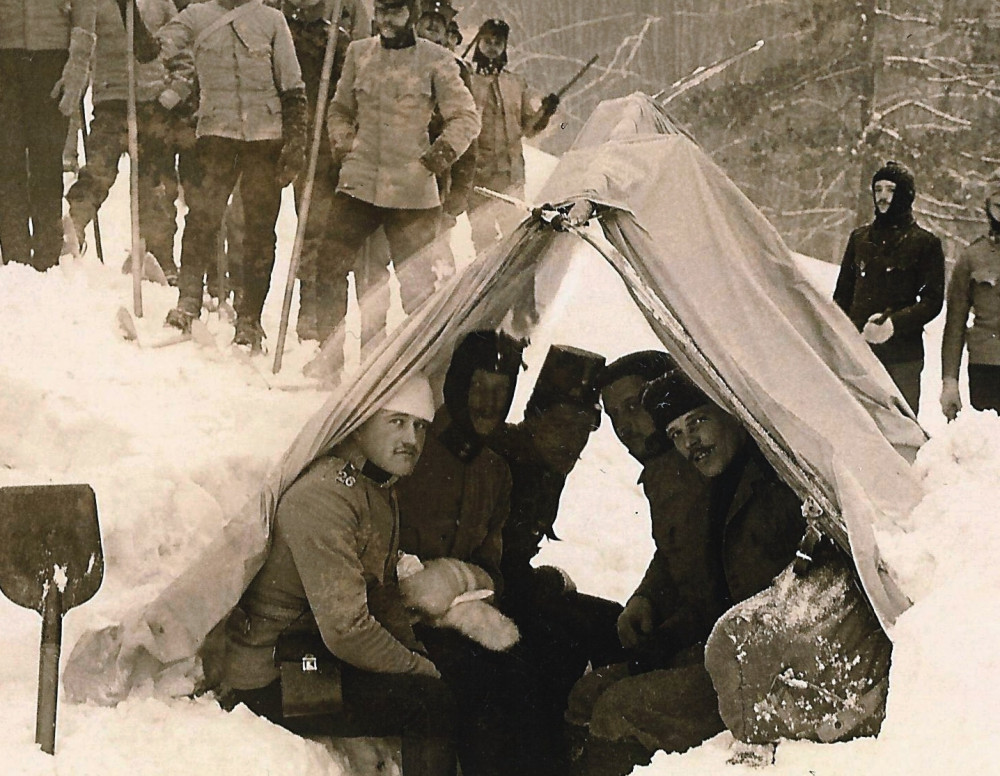
They were inside a tent made of one piece of cloth. Veteran climbers call it Zdarsky tent named after the author, the famous Austrian climber Mathias Zdarsky. This is a bag measuring 2 by 1.5 m (6.5 by 4.9 ft). Initially it was made of thin tarpaulin. Later on, when new materials were introduced was manufactured from percale with aluminium coating; weighs 1 kg (2,2 lb). The drawing below is the closest I could find to the setup KuAI group was trying for, imagine it horizontally, Kuznetsov being the anchor of the rope.


The Zdarsky tent is versatile. It can be suspended on a ledge, too.
Here is an original photo of Zdarsky tent. Zdarsky is also thought to be the inventor of the bivouac sack, among many other inventions in the sphere of the ski mountaineering. He was called the "father of alpine skiing".
– 6 –
The followings are his account of the search.
On January 30 I got a call from the head of one of the groups of our ski mountaineering section at the Moscow State Aviation Institute Victor Samodelov. He told me they had found several bodies on the Chivruay Pass in the Lovozerskiye Tundry, Kola Peninsula. They had reported the incident in Kirovsk, but the films haven't been developed yet. I knew the head of the Murmansk rescue service, Anatoliy Ostrovskiy, who also called me and asked when would Victor's group return to Moscow to show me the photos they made of the incident. I made copies of the photos and handed them to the captain of the first plane to Kirovsk. An order was issued from the sports club of our institute and the All-Union Main Directorate for Mountaineering. The next day, February 2, I flew to Kirovsk as the head of the rescue team of our university sports section. In three weeks, I had to present a diploma for a master's degree in aeronautics. There was a small fuss, but everything turned out to be all right.
When I arrived in Kirovsk, Anatoliy Ostrovskiy transferred me directly from the plane to the departing helicopter. We flew to Chivruay Pass to inspect the scene and transport the bodies to Kirovsk. There was a large group of police, prosecutors and rescue service representatives.
The cities of Kirovsk and Apatity are mining and processing centers of ores containing phosphorus, from which fertilizers are made for the agriculture. These two cities manufacture more fertilizers than anywhere else in the world. Below is a photo of a substation providing electricity to all the mines and factories of the two cities.

View from the helicopter taking off from Apatity airfield. The low sun of the polar region. February 2, 1973.
In the early morning of February 2, 1973, we flew from the Apatity airfield. The cities of Kirovsk and Apatity are above the Arctic Circle on the Kola Peninsula. In the photo you can see the sun is very low. It is very typical for the Arctic Circle in winter. The day of departure was very cold. The temperature was -27°C (-17°F) with a light wind. It feels much colder due to air of very high humidity coming from the Barents Sea and the Gulf Stream. When I was in the army in the same region, we had a case when aircraft engines were dying in flight preparation because the humidity sharply reduced the temperature of the gases in the aircraft engine’s turbines. Water evaporation absorbed a great deal of heat produced by the fuel.

View of Khibinskie Tundra from the helicopter on February 2, 1973.
You can see the typical landscape of these places - lakes and swampy plains between the mountains. Half way between Kirovsk and Chivruay Pass there is a large lake called Lake Umbozero, which separates Khibinskie Tundry and Lovozerskiye Tundry. The photo was taken back from the flight overlooking the Khibinskie Tundry. They are not too high, on average 900-1000 m (2900-3200 ft) above sea level. Most of the peaks are flat, their slopes are steep.
We took off from the place on the left, behind the biggest mountain and flew about 90 km (55 mi). That day for the first time after January 26 was good flying weather with temperatures around -20°C (-4°F). Such frost on the Kola Peninsula is felt worse than somewhere in Siberia as -30 to -35°C (-22 to -31°F) due to very high humidity. The Gulf Stream flows nearby and often there is wind coming from the Arctic regions. We transported the five bodies on two flights to Puncha settlement, the next day they were taken to the Kirovsk city morgue.

On February 2, an Mi-4 helicopter left from the abandoned geologist settlement of Puncha. Mi-4s were also used to search for the Dyatlov group.
The search operation was massive (see map on page 2). Servicemen from the Kandalash division combed the plateau with mine detectors. Unfortunately, no new findings were made in February.
– 7 –
Vladimir Borzenkov participated in the search for the KuAI group in three rounds in 1973: February 2-10, March 8-15, and May 23 - June 4.
The second round of searches took place in March. Lake Seydozero, valleys of Chivruay and Kuftuay Passes on both sides were thoroughly examined, many searches were made on the plateau. During this time a frame-board cabin for the search team was delivered by a military helicopter near the location where the first five bodies were found, making searches on the spot possible and to thoroughly examine the slopes around the site.

Search team cabin on the Chivruay Pass plateau
You can see traces of many avalanches in the below photos of the Chivruay Pass slopes towards the Kitkuay River. We had to take precautions.

Avalanches on the Kitkuay gorge slopes.
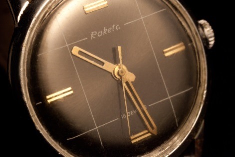
During this period of the search we conducted experiments that may be of interest when analyzing the case of Dyatlov group as well. In both cases the wrist watches of all deceased stopped in a relatively short span of time, less than an hour of each other. We were trying to find the cause of this synchronous halt of movement. We took several different types of watches and started hanging them in the wind or putting them on the roof of the cabin. But the watches kept going until they unwound to full stop at different times. Then Anatoliy Ostrovskiy suggested putting them on ice. A body is an aggregate of bio-fragments consisting mainly of water and when it freezes it becomes a solid piece of ice. For our experiment we had five mechanical watches of different brands: Slava, Sportivnye (this was my watch), Vostok, Raketa, and a Japanese watch Seiko Sportmatic that belonged to a rescue worker who had traveled to Finland earlier.
All watches stopped at about the same time with a span of 30-40 minutes. The total running time was around 2.5 hours. This observation allowed us to determine the approximate time of death of most of the KuAI group members. If I remember correctly the time on the watches of the first five bodies was close to 1:00. There is no way of telling if it’s am or pm.
Pieces of equipment were scattered by the wind on the plateau during the incident.

Sleeping bag that belonged to the KuAI group
This photo shows a sleeping bag that was found about 150 m (500 ft) away from the tent and bodies. Items were carried by the wind until they were stopped by an obstacle, such as a stone or snow mound, and then pressed against it tightly. Some were covered with snow and were found only when the snow started to melt, or when the wind in another direction caused the snow to descend from part of the object. We tried to find out patterns in the location of the items being scattered by the wind but it didn't work out. Apparently, after the wind changed direction, some of the items not anchored to anything were carried in another direction. There was no way of telling how far away and in what direction were the items scattered.
During the first, second, and third rounds of searches a lot of footprints similar to those in the Dyatlov Pass incident were found. To find tracks with clear direction and a pattern in the movement of people is very unlikely. On the Chivruay Pass 10 to 15 footprints located in different places were documented. We were unable to determine how many people left them. Very often the traces were not paired, consisting of one footprint and the other was nowhere to be seen. Trajectories of their movement were hard to establish, and we did this towards the very end of the search, when the highest number of traces were found, and only by statistical method. The trajectories can be considered simply probable, rather than definitive. For the record were entered the places of detection of the traces and belongings from the beginning to the very end of search. The condition of preservation of footprints was different. The tracks became visible either when the wind direction changed at the very beginning of search, or when the snow started melting towards the end of the operation.
– 8 –
While the helicopter was landing on the plateau the day after I left, bringing provisions and supplies, rotors blew the snow from underneath and a piece of rope was uncovered. This is how Lidiya Martina and Aleksander Novosyolov were found 300 m (980 ft) from the tent. Some footprints were found near them.

A military helicopter on Chivruay piloted by Captain Eugene Panko
I was friends with Captain Eugene Panko. I was doing my military service at the same airfield in Monchegorsk a year later, not in a helicopter squadron, but in the aviation intelligence regiment.
Helicopters were used for air surveillance but the efficiency of such search was very low. There were a lot of rocks and other foreign objects on the complex terrain which included relief forms, inflatables, and cornices on the slopes that were impossible to properly examine in the very short time of flying over. The only chance we had is if we were to spot a very clear silhouette of a body.

Photo from the Chivruay Pass looking east. Air surveillance of the Chivruay river.
The helicopter is about 50 m above the plateau, the Chivruay River valley is in the upper part of the photo. Below is Lake Seydozero and the eastern part of the Lovozerskiye Tundra "horseshoe". Here is that same view in a photo taken from the plateau.
The photo above was taken near the Northern ascent on the plateau. The point of the uppermost part of the ascent is to the left. You can see the steep left (orographic) and snow-covered right bank of the Chivruay River, as well as almost all the way up from Lake Seydozero. The lake itself can’t be seen as it’s behind the cliff on the left-hand side.

Photo from the Chivruay Pass looking west. Air surveillance of the Kitkuay river.
The valley of the Kitkuay river from a helicopter. In the foreground, the descent started from the narrowest junction of the Chivruay-Ladv and Kitkuay rivers’ watershed. On the right you can see the cliffs of the right (orographic) bank of the Kitkuay river valley. Khibinskie Tundry and Umbozero lake covered with ice can be seen in the distance. The group’s tent stood near the second ledge of the cliff.
The found bodies gave us no clue whatsoever as to what happened. We made many important observations of the terrain and weather, we tried different methods of search in small groups of 8 to 10 people. The amount of work was exhausting. We inspected 1-1.5 square kilometers (0.4-0.6 sq mi) every day. It was often necessary to go down and climb steep and dangerous slopes. The weather varied, but it was rarely sunny with no wind.
I was supposed to join the third round of searches during the holidays in May expecting that the melting snow cover would allow us to find the remaining three bodies. Instead I had to attend sad events in my life. First a relative died and I had to arrange her funeral. Then at the beginning of May I received more bad news from Irkutsk that the body of a friend of mine was found. He disappeared crossing the Bilyuta River in the summer of 1972. The incident happened at the confluence of the Bilyuta and Kitoy Rivers at the Bilyuta River’s mouth.
The same day I flew to Irkutsk with the rescue team of our university's mountaineering club and spent more than a week completing the search that was launched when he disappeared in 1972. I can draw similarities between this episode and the search for Dyatlov group. The body was very badly and quickly destroyed by water after thawing. During the whole winter, the body was frozen in ice near the bank of the Kitoy River, near the Fedyushkina River, 13 km (8 mi) down from where it had disappeared.
In the first days of May 1973 hikers from Irkutsk found him still inside the ice block, but without any noticeable damage, except for what is usual for someone who died by drowning. We arrived 5 or 6 days later and found that parts of body tissues washed with water were almost completely destroyed to the bone. There were no visible changes on the body parts still encapsulated in ice. This was an illustration of the damage water can do in less than a week. The observation can be applied to the bodies found in the water in May in Dyatlov case.
I couldn’t return to Chivruay for the third time until late May. Two more KuAI members had already been found at the bottom of the gorge, on the right side of the Kitkuay River. They were Valentin Zemlyanov and Artyom Lekant. The clock on one of their wrists showed 4.33, presumably am.
Together with my friend and colleague at the department at the MAI Yuri Kozin we arrived at the Murmansk airport in the morning of May 22, then took the train to Kirovsk where the rescue service was based.

The city of Kirovsk
The city’s central square is called "Round Square". In plan it has a semi-circular shape, but everyone calls it "Round". There is the central store, "Bolshoi Vudyavr", which is the name of the big lake. The city of Kirovsk is located on its shore. When we arrived on May 23, 1973, there was still snow everywhere. In the background you can see the slopes of Mount Aykuaiventchorr where there are many popular ski slopes. In the spring, especially in March and April, many skiers from all over the USSR come to Kirovsk. Unfortunately, due to lack of discipline and skiing on unauthorized slopes, skiers and snowboarders die in avalanches almost every year.
There was a group from Kuybyshev city, which included experienced hikers from KuAI. Nowadays this city is called Samara. The air force wasn’t involved. Military helicopters were on routine maintenance work, and to order a special helicopter from civilian companies was very expensive. The next morning, we took a bus to the Umba village, which is on the southern end of Lake Umbozero. Next, we embarked on a railcar that carried mine and railway workers to the of Puncha village. There was an improvised search headquarters.

A guide with a dog sent by the militia, Yuri Kozin and Veniamin Mochalihin boarding the railcar to Puncha village
Puncha settlement was abandoned by geologists a few years before, but was used as a base to store equipment and shelter railway workers and miners who happened to be there. In the Northern territories, such points are made for emergencies like a breakdown of a train. People and equipment need shelters in winter when temperatures drop and strong winds are common.

Puncha settlement
– 10 –
In the settlement we met with two soldiers from the engineering units sent by the military to help with the search. The guys were happy to get away from life in the military unit. They even asked not to be relieved after the two-week shift. They were in no hurry to go back to their regiment.

Two soldiers were assigned in Puncha to help us before we left for Chivruay Pass.
We had the following situation on hand. Supplies were driven to us by the military together with the soldiers. The rescue team that we were replacing left two days before. The military was not providing the backpacks, it was the Sports Club’s responsibility. We were left with the provisions in boxes, the soldiers and some rope. We had to improvise backpacks which was a very inconvenient way to carry the load, but there was nothing we could do.

A soldier being helped to pick up the improvised backpack
We wanted to take advantage of the beautiful weather and since it was already a Polar day i.e. the sun is above the horizon all day long, we decided to get going the same day. The distance was about 25 km (16 mi) and we had to scale 700 m (2300 ft). It was hard but we were a search party, not just a group of hikers. At first, we had to walk 8 km (5 mi) along the railroad tracks.

The beginning of the journey to Chivruay Pass - 25 km (15 mi) ahead and 700 m (2300 ft) up

The forest border on the Kitkuay river
Yuri Kozin and I went ahead on skis and made tracks in the snow for the Kuybyshev team who were helping the soldiers carry the inconvenient load.
– 11 –
Yuri and I are in a snow free area on to the high left side of the Kitkuay River. We left our skis down for the soldiers because the snow became deeper and walking became almost impossible. Their backpacks were about 20 kg (44 lb).

Scaling up the left slope of the Kitkuay river valley without skis
In the photo above Khibinskie Tundry and Umbozero lake are in the distance, covered with ice. The ice is still about 1 meter (3 ft) thick. The snow has already melted on a sunlit part of the slope, but there is still a lot of snow below. This is the end of May in the Arctic Circle.

The Kitkuay river valley
Good view of the whole valley of Kitkuay River up to Chivruay Pass. At this point we were still 12 km (7 mi) from our destination. I have marked our path to the plateau. The KuAI search group wasn’t supposed to go up but continue along the Kitkuay riverbed.
This photo of the search team cabin on the Chivruay Pass plateau was taken late at night.
We reached the search team cabin late at night. The sun was up in the sky. Anyone unfamiliar with this phenomenon would assume this photo was taken during the day. In the photo made right after we arrived at the cabin are Yuri Kozin (front) and Veniamin Mochalihin (back) securing the skis so that they won't be blown away.
Our cabin was 3 by 4 m (10 by 12 ft) and accommodated up to 8 people. The construction was timber frame with planks on both sides and synthetic insulation inside. There was no roof, only a ceiling filled with mineral wool, covered with polyethylene film, which was held up by stones on top. The reason for the lack of a roof was so that the cabin could be transported by a helicopter. Taking in consideration the height and the constant winds, having a roof would have made it impossible to lift off.
The cabin was furnished with bunk beds, a small table and a stove. It was the same as usually used by winter hikers in tents, but it was made of thicker iron and was installed stationary. For more thermal inertia, it was additionally covered with stones. Because of this, it held the heat longer. Of course, the stove and other equipment was brought to the pass later than the cabin itself.
– 12 –
In this search operation there were two different teams. Ours consisted of Yuri Kozin from the MAI and myself from the MAI and the Main Hiking Department of USSR Trade Unions, and the team of six from Kuybyshev. We decided that the head of this joint group will be Veniamin (Venya) Mochalihin, and I was assigned the role of chief inspector. We had no disagreements, we worked very well as a team, and all decisions were made together as a group. Venya is a wonderful person. He had a sports master’s degree in the USSR. At this particular moment of his life he was in a peculiar position having recently returned from his skiing trip to the North Pole. Unfortunately, it was unsuccessful, but not because of some mistakes or shortcomings of the group itself. I would like to take the time and say a few words about him.
By early 1973, among the outstanding ski hikers in the USSR, there were already several teams that could make such a journey in autonomous mode. In Moscow, it was a group that formed around Peter Lukoyanov. And there could have been 2-3 teams of approximately the same level of 6-8 people each. There was a group in Leningrad. I remember well Sergey Kolyubakin, with whom we exchanged ideas on mountaineering equipment in the Main Hiking Department USSR Trade Unions. There was a group in Arkhangelsk, which included Edwin Gibshman. There was group from Sverdlovsk, which probably included Sergey Harin. In Kuybyshev, the head of the group was a professor from KuAI Peter Molotov, and Venya Mochalihin was a member of this group. I am only mentioning those who I remember almost 50 years later.
All of them were preparing for such a journey to varying degrees, all had different opportunities, but it so happened that by the spring of 1973, a group of proud Kuybyshev, led by P. Molotov, went independently on the route, having coordinated everything and received the necessary material support. The group was well-trained and was given high quality equipment of the time. This included home-made but very practical small-size radio stations designed by P. Molotov. He was a graduate of the Radio Faculty of KuAI. These radio stations were the reason why they couldn’t complete their route. At the same time, the USSR Navy conducted submarine testing in the same area. When they found an unidentified radio transmitter in their testing area a helicopter with special forces was dispatched and took the group to Arkhangelsk. To the question: "Who are you and who can confirm your identity?" the leader gave a concrete answer: "KuAI Rector, Komsomol 1st Secretary and Chairman...". But since the group was taken off the route, the expedition was disrupted. As far as I know this was the first attempt to reach the North Pole by an unsupported amateur hiking group. It was aborted for reasons not related to the group's capabilities.
There were several attempts afterwards but only two succeeded. In 1979 Dmitry Shparo with a group of seven people reached the North Pole. But this cannot be called a full-fledged autonomous journey. They had unlimited means and information support by "Komsomolskaya Pravda" (and the Komsomol Central Committee). They advertised almost every sneeze in the group, and received food and equipment by airdrop almost every 3-4 days. Even when they lost their skis while crossing a crevice, new equipment was delivered quickly. For another group it would’ve been the end of the route with a possible rescue operation. Only in May 1994, the Tomsk group led by Vladimir Semenovich Chukov from Moscow, reached the North Pole in full autonomy and without any help. This is especially significant, because it was the beginning of the 90s.
After this journey, Venya was always looking for vitamins. He even packed greens for me and the dog trainer. I don't know how he knew how many people would be in the group. Probably this information was given to him by Anatoliy (Tolya) Ostrovskiy, the head of region’s rescue department.

Veniamin Mochalihin makes salad for the whole group.
Military helicopters were flying along a planned route that passed by us on average twice a week. We contacted them and exchanged information. Then they would transmit that information over the phone to the regional rescue department. We had no other operational connection. When it was necessary, and when the conditions allowed, they would bring us supplies we had requested on the previous communication exchange. But all this was done inside military training flight plans. If we urgently needed a helicopter, we had to send someone to Puncha. We never sent only one person, they had to go in pairs for safety reasons. From Puncha settlement they would call the rescue base in Kirovsk over the phone.

Radio communication with a passing military helicopter
A typical working day was spent by looking through as much detail as possible and search area of more than 1 square kilometer (0.4 square miles) on the plateau and the vicinity. Viewing the terrain through binoculars should have reduced the effort and time spent on searching. However, it was possible to find something purely by chance.

Binoculars were used to examine the area surrounding the plateau.
We searched the nearest cliffs of the right bank of the Kitkuay River with binoculars. The next step in the search every day was to inspect the slope almost all along the cliffs.

Climbing the steep cliff side of the Kitkuay river’s right bank
We averaged ten descents and ascents a day, and by evening the fatigue was overwhelming.
The military administration brought us an amplifying optical tube and we made two devices from it for detailed viewing of distant parts of the slopes. Every morning we carefully examined the terrain. If a suspicious rock was spotted, we had to get there on foot. If it wasn't for the optical enhancement the search area would’ve been three times larger. The observer was also "watching the air" for military helicopters flying by schedule, which were our life line with the world.

Examining distant slopes through powerful optical instruments
– 14 –
The militia insisted that we used rescue dogs. In my opinion they were useless in those conditions. A dog searches well on solid ground. In extreme cases, on soil with little vegetation. Under the snow, the dog can't find anything. An exception is when the layer of snow is very thin or there are gaps that let the smell sift through. This is how dogs find people under avalanches in the mountainous regions of Europe. Under a thick layer of snow or when the snow starts to melt, a dog can't smell anything. That's exactly what we had - rapidly melting snow.

The search dog in Puncha
Using dogs in the mountains of the Kola Peninsula in winter or on snow was not expedient. The mountains are volcanic rocks, which in many places have a porous and brittle structure on the surface. On the first day when the dog was brought to the pass and we showed her the belonging of the group, she was running all over the place in search. Because the items were so thoroughly wet, she was pouncing on everything wet, and could even pick up the smell. On the second day on the plateau the dog already had cut and bleedings paws. Dogs need to use boots in a terrain like this (like the safety boots police dogs wear in hazardous environments to protect them from needles and broken glass - ed. note). When she cut her paws, she looked so pitiful we sent her back to Kirovsk.

Typical equipment: flags, VHF radio station, camera, notebook, fountain pen, compass.
Although the snow was hard, walking without skis on large area was not possible. One could fall into wet and heavy snow and sprain an ankle or knee.

Yuri Kozin digging in the snow near where a piece of clothing was found.
– 15 –


The couloir was so steep at the top that we had to secure a rope to go down.

In the photos above is a couloir near the search cabin. We had to go down often to search the lower part of the valley. The couloir was so steep at the top that we had to secure a rope to go down. The first two photos show how fast the snow was melting. It is the same place; the photos were taken 2 or 3 days apart. The slope is more than 150 m (450 ft) from the flat part to the plateau, and the steepest part (40 to 60 degrees) is at least 80 m (240 ft).
On June 1, 1973 a suspicious object was spotted below practically under the place where our cabin was standing. During the night it melted out of the snow, although the area and its vicinity were searched several times the night before. It happens very often. The place is unremarkable, there is no sign that something is there, and then you suddenly see what you are looking for.

The last body was found only on June 1, 1973.
Nail Maneev from the Kuybyshev group and myself started the descent to examine the object that looked like a human body.

Nail Maneev going down the slope to investigate.
– 16 –
At first, we let one rescuer to assess the safety of the descent. He has to report on the condition of the slope. It is unacceptable to risk everyone's safety and for the whole group to start descending and get into an accident. The search should not turn into rescue of the rescuers.

The slope is reported to be safe to come down.
A note on the range of the small portable radios we used. On the plane our walkie-talkie had a range of 200-300 m (600-900 ft), which, working upwards i.e. ground to air, increased to 500 m (1500 ft). The range when used downwards i.e. air to ground was as in the specification of no more than 100 m (300 ft). We used a Japanese model on the 433 MHz range with an output power of about 0.1 W. Unfortunately I can’t recall the manufacturer and the model of the devices.

Nail Maneev from the Kuybyshev search party reporting on the safety of the slope
We went down with mixed feelings; the relief that we have found the last body, and the realization that the fate of the group is now confirmed.

A tragic find
Furthermore, it was necessary to carry out all formalities; to write the report of discovery, the inventory of items on the body, photographing the body for the criminal case and drawing a scheme of the scene. We could identify the body because there were people who knew this person well, but it was decided to do it later when the body was delivered to the morgue in Kirovsk. The decision was substantiated with the fact that there was no investigator among us to manage the formalities. He couldn't stay in place for more than six months. This wasn't the only criminal case he was involved in. That's why there was an order that some investigative actions were assigned to the search team.
When the previous two bodies, Lekant and Zemlyanov, were found, the search team called the investigator to the site and waited for two or three days. When I read the protocol of discovering of the bodies, I noticed that city investigators were not able to describe accurately the place in terms of terrain forms and other landscape details. Even the orientation of the scene very approximate probably it was done visually without a compass.
All these factors had been taken into account. We had noted everything clearly and habitually: body axis with compass angle, coordinates relative to the riverbed, the distance from the mouth of the river on lake (thankfully the lake has already thawed in this place), and so on.

The last body is found.
It is necessary to note an important observation, very often referred to in the Dyatlov case, the red or orange color of the bodies. The discoloration is attributed to anything but natural causes (see #Orange). In fact, the recently extracted frozen body does have a reddish color, more accurately red-orange. It's a common occurrence in deaths due to cold.

Detail of a recently extracted frozen body
The precise medical definition can be found in the Handbook of Forensic Medicine, it’s called frosty erythema or Keferstein stains.
This fragment was found when we removed the body from the snow to examine it. It looked like blood. It turned out to be a trace of the dye from the storm jacket that got wet. The jacket's original color was military type camouflage green gray. When the dye dissolved its color changed.

Discolored snow near a frozen body
The last body was taken to the Kirovsk city morgue. After all the medical and legal procedures, it was transported to Kuybyshev.
We made the description of the items found according to the standard recommendations; we even had a photo of the corresponding page of the investigator's manual. There is one interesting thing I want to mention. When Yura Kozin was taking the items from the body and bagging them, he said something I remember clearly to this day: "On his left hand there is a wrist watch... which shows the time of 6 hours 5 minutes and 15... 16 seconds... What? It’s still going!" The only part I am not sure is the make of the watch and the seconds. The important thing was that the watch was still working after being removed from the frozen body. And this was the end of the experiment with the watches we started in March.
– 17 –
In conclusion, after finding all bodies, the most likely scenario of what happened on the tragic night of January 26, 1973, is the following:
- Lidiya Martina had mountaineering experience and had to know what to do under such conditions. Aleksander Novosyolov was a novice but he was physically stronger than Lidiya. Since wandering alone in such conditions is not recommended, the two probably went either to explore the way down to the Chivruay River at the Northern exit on the plateau or find a way down to the Kuftuay River north of their tent. We found only a few tracks that could be attributed to a return from either of these two options. Both bodies showed signs of paradoxical undressing or vasodilatation syndrome; feeling warm in case of lethal hypothermia. A scientific paper on this problem was published some 20 years after the incident.
- Valentin Zemlyanov and Artyom Lekant explored the most promising path, although it might have been the most difficult; the classic, technically least difficult descent to the Kitkuay River. The wind was hindered their progress as they had advance almost straight against hurricane force winds at very low temperatures. Judging by where they were found they went all the way down but couldn’t return to the tent. The tracks on a significant section showed they were backtracking their way to the tent but didn't have the strength to reach it. Their bodies were found 10 m (33 ft) apart.
- Ilya Altshuler was found last and also furthest from the tent. He was only 150 m (450 ft) from his tent, but 80 m (240 ft) of them were vertical. There is a well-founded opinion that he was trying to climb back to the tent. In principle it's possible. Ilya could have known it because a year earlier he was hiking through the Chivruay Pass. In my opinion, at that time they went down the classical descent - directly from the pass to Lake Kitkuay. It is possible that Ilya went most of the way together with Zemlyanov and Lekant, but somewhere they got accidentally separated.
All members of the group who left the tent were adequately dressed but the weather was extreme. Survival under such conditions is a big challenge in general. Everyone had a full set of hiking clothes and extra sweaters. Some had double and triple wool sweaters. Lidiya Martina, Valentin Zemlyanov and Artyom Lekant were wearing insulated jackets. Ilya Altshuler was additionally wearing a warm aviation winter jacket but he didn't wear gloves. Judging by all indications, he died of total exhaustion and lost muscles tone. It is enough to stop only for a few minutes and an irreversible cooling process would begin.
– 18 –
On June 2, 1973, a helicopter was called to take the body and our search team was flown to Kirovsk city. Two soldiers remained on the plateau to collect the equipment provided by the military. Subsequently, the cabin was lowered by helicopter into the valley of the Kitkuay River and it was called "the cabin of seismic probing". I saw it much later, in the summer of 1983 and then in the winter of 1990 when it was almost unsuitable for a shelter. This is what it looked like.

The Chivruay incident search cabin in the winter of 1990
The cabin was removed from the plateau due to concerns that the winds might destroy it. We were told it was used by geophysicists for seismic surveys, but there were no additional structures there. Maybe the seismic sensors were installed only for a short time. The winter of 1990 was marked by strong winds and low temperatures. The camera froze hence the poor quality of the photo. In the background you can see a smooth descent from the plateau, and where the steepest slope begins to the left of the center of the frame, the bodies of Zemlyanov and Lekant were found below.
Jura Kozin, Veniamin Mochalihin and I were writing criminal case papers and search reports. After our arrival from the Chivruay Pass, we had been in Kirovsk for 3 days when Anatoliy Ostrovskiy came to us and said he had received a call from the CPSU regional committee and wondered how the operation ended. They "strongly recommended" to write an explanatory memo about the work done by himself starting with Dear Leader I. Brezhnev. Tolya decided that I am suited best to write the note since I had to produce a report to the Main Hiking Department USSR Trade Unions and both papers should be coordinated. I spent all night on the explanatory note. Next day there was a military plane to Kuybyshev city. We arrived in the morning to the Apatity-Kirovsk airfield, but it turned out that the passing An-12 plane had to land at Afrikanda airfield because it didn't get permission to land at the Kirovsk airfield due to insufficient runway length. We were dispatched to the Afrikanda airfield as a matter of urgency.

At the Apatity airfield
In the photo above: The commander of the Mi-2 helicopter crew, Captain Evgeniy Panko - my friend in the army in 1973-1975; the chief of the Apatity airfield with the rank of Colonel; one of the members of the unofficial rescue team of the Kirovsk city; officer headquarters of the Apatity airfield with the rank of Lieutenant Colonel; Head of the Rescue Regional Department Murmansk region Anatoliy Ostrovskiy - my friend and adviser on numerous visits to this region.
Yuri Kozin and I flew to Moscow. Fortunately, the plane’s route was through Moscow’s Ostafyevo airfield, and didn't have to land somewhere in Kalinin city, now Tver, or in Ryazan city. We were very tired, not only physically, but also psychologically. We wanted to get back home.
– 19 –
Almost 50 years have passed, but the memory of the KuAI group is kept alive by their friends and followers, "hikers of distant roads".
Subsequently, friends of the members of the doomed KuAI group from Kuybyshev city, now Samara, and the Grushinsky bard song festival raised a monument on Chivruay Pass.

Monument of the KuAI group on Chivruay Pass
Umbozero lake can be seen on the left-hand side in the distance. Khibinskie Tundra is covered with clouds.
In January 2019, almost on the anniversary of the KuAU group’s death, Victor Voroshilov, an entrepreneur from Nizhniy Novgorod and cousin of Anatoliy Pirogov, member of the perished hiker group, visited Chivruay Pass.


Victor Voroshilov at Chivruay monument
Unfortunately, Victor's life was tragically cut short. On September 17, 2019 he was killed in his garage by a criminal disgruntled with his business affairs. His murder has nothing to do with his interest in the tragedy on Chivruay Pass.
I was the first person he approached to find more information on the case and we worked together for almost a year. I'm deeply saddened by Victor’s death. He was a good man.
You can discuss this article in the forum where Borzenkov is a member.

Young Borzenkov

Dr. Vladimir Borzenkov on Russian TV1 with Malahov
Deadly Passes
Related articles
 Watches in the Dyatlov group
 Dyatlov vs. Chivruay
 Chivruay incident - 1
 Chivruay incident - 3
 Chivruay incident - 4
 Buryatia Dyatlov Pass
 Sokhondo Nature Reserve
 John Garner Pass
 Deadly Patagonia Storm
 Death in the Alps
 Death in the Alps - 2


